 vesseltracker.com
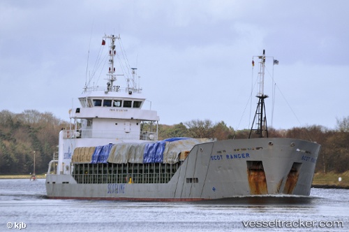
 SKY RANGER
Current Status
Where is the vessel?
SKY RANGER is currently in Near PATRA, based on AIS data received about 1h ago.
Latest AIS update:
Current position: 38.25343° N, 21.73501° E (Near PATRA)
Average speed (last 7 days): Loading…
Average speed (last 30 days): Loading…
Vessel profile: SKY RANGER is a General Cargo with dimensions m x m.
This page combines live AIS, route history, probable destination signals, nearby traffic, and port activity for practical vessel monitoring.
The current position of vessel SKY RANGER is 38.25343 lat / 21.73501 lng. Updated: 2026-04-22 08:03:29 UTCNearest reference points:
- Near Káto Achaïa
- Near MESSOLOGGI
- Near Meganísi
Currently sailing under the flag of Panama ![]()
Details:
Live Vessel SKY RANGER Analytics (details, animations, etc.)
Recent AIS points (UTC):
2026-04-22 04:40:19 UTC · 38.25344, 21.73503 · SOG 0 kn · COG 96°2026-04-22 05:59:29 UTC · 38.25342, 21.73498 · SOG 0 kn · COG 95°
2026-04-22 07:06:19 UTC · 38.25339, 21.73499 · SOG 0 kn · COG 95°
2026-04-22 08:03:29 UTC · 38.25343, 21.73501 · SOG 0 kn · COG 100°