 vesseltracker.com
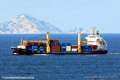
 HONOR VOYAGER
Current Status
Where is the vessel?
HONOR VOYAGER is currently in Near Hibikishinko, based on AIS data received less than 1h ago.
Latest AIS update:
Current position: 34.08118° N, 130.76149° E (Near Hibikishinko)
Average speed (last 7 days): Loading…
Average speed (last 30 days): Loading…
Vessel profile: HONOR VOYAGER is a Container Ship with dimensions m x m.
This page combines live AIS, route history, probable destination signals, nearby traffic, and port activity for practical vessel monitoring.
The current position of vessel HONOR VOYAGER is 34.08118 lat / 130.76149 lng. Updated: 2026-04-20 05:42:17 UTCNearest reference points:
- Near Hibikishinko
- Near KITAKYUSHU
- Near Kokura
Currently sailing under the flag of Panama ![]()
Details:
Live Vessel HONOR VOYAGER Analytics (details, animations, etc.)
Recent AIS points (UTC):
2026-04-19 23:49:32 UTC · 34.85522, 129.39291 · SOG 13.8 kn · COG -1°2026-04-20 04:15:34 UTC · 34.27634, 130.43861 · SOG 14 kn · COG 128°
2026-04-20 04:23:34 UTC · 34.25924, 130.46977 · SOG 13.9 kn · COG 127°
2026-04-20 05:42:17 UTC · 34.08118, 130.76149 · SOG 13.6 kn · COG 131°