 vesseltracker.com
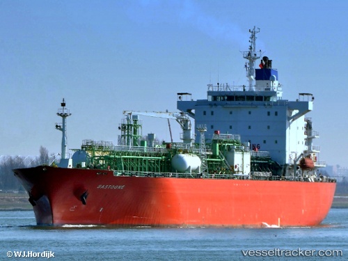
 BOGAZICI
Current Status
Where is the vessel?
BOGAZICI is currently in 67 nm S of Keti Bandar, based on AIS data received about 1h ago.
Latest AIS update:
Current position: 23.02224° N, 67.47195° E (67 nm S of Keti Bandar)
Average speed (last 7 days): Loading…
Average speed (last 30 days): Loading…
Vessel profile: BOGAZICI is a Lpg Tanker with dimensions m x m.
This page combines live AIS, route history, probable destination signals, nearby traffic, and port activity for practical vessel monitoring.
The current position of vessel BOGAZICI is 23.02224 lat / 67.47195 lng. Updated: 2026-04-22 08:00:23 UTCNearest reference points:
- 84 nm SW of Keti Bandar
- 16 nm S of Kiamari
- 13 nm W of Måndvi
Currently sailing under the flag of Panama ![]()
Details:
Live Vessel BOGAZICI Analytics (details, animations, etc.)
Recent AIS points (UTC):
2026-04-22 05:01:30 UTC · 23.02272, 67.47162 · SOG 0 kn · COG -1°2026-04-22 05:42:23 UTC · 23.02256, 67.47177 · SOG 0.2 kn · COG 244°
2026-04-22 07:47:07 UTC · 23.02216, 67.47199 · SOG 0.1 kn · COG -1°
2026-04-22 08:00:23 UTC · 23.02224, 67.47195 · SOG 0 kn · COG 257°