 vesseltracker.com
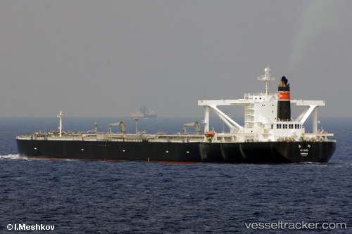
 KIHO
KIHO
Current Status
Where is the vessel?
KIHO is currently in 16 nm NE of Hachinohe, based on AIS data received about 2h ago.
Latest AIS update:
Current position: 40.73022° N, 141.77153° E (16 nm NE of Hachinohe)
Average speed (last 7 days): Loading…
Average speed (last 30 days): Loading…
Vessel profile: KIHO is a Crude Oil Tanker with dimensions m x m.
This page combines live AIS, route history, probable destination signals, nearby traffic, and port activity for practical vessel monitoring.
The current position of vessel KIHO is 40.73022 lat / 141.77153 lng. Updated: 2026-03-27 03:21:41 UTCNearest reference points:
- 26 nm E of Hachinohe
- Near Yokohama, Aomori
- 11 nm NW of Yokohama, Aomori
Currently sailing under the flag of Panama ![]()
Details:
Live Vessel KIHO Analytics (details, animations, etc.)
Recent AIS points (UTC):
2026-03-26 21:35:11 UTC · 40.73029, 141.77158 · SOG 0.3 kn · COG 153°2026-03-27 00:23:50 UTC · 40.73035, 141.77156 · SOG 0.1 kn · COG 143°
2026-03-27 02:33:12 UTC · 40.73021, 141.77127 · SOG 0.1 kn · COG 143°
2026-03-27 03:21:41 UTC · 40.73022, 141.77153 · SOG 0.2 kn · COG 149°