 vesseltracker.com
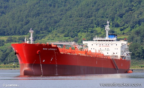
 NAVE LUMINOSITY
Current Status
Where is the vessel?
NAVE LUMINOSITY is currently in 14 nm W of ROBBEN ISLAND, based on AIS data received less than 1h ago.
Latest AIS update:
Current position: 33.81826° S, 18.09914° E (14 nm W of ROBBEN ISLAND)
Average speed (last 7 days): Loading…
Average speed (last 30 days): Loading…
Vessel profile: NAVE LUMINOSITY is a Tanker with dimensions m x m.
This page combines live AIS, route history, probable destination signals, nearby traffic, and port activity for practical vessel monitoring.
The current position of vessel NAVE LUMINOSITY is -33.81826 lat / 18.09914 lng. Updated: 2026-04-20 00:16:20 UTCNearest reference points:
- 12 nm W of ROBBEN ISLAND
- Near HOUT BAY
- Near Cape Town
Currently sailing under the flag of Panama ![]()
Details:
Live Vessel NAVE LUMINOSITY Analytics (details, animations, etc.)
Recent AIS points (UTC):
2026-04-19 19:50:51 UTC · -34.17105, 18.05315 · SOG 11.5 kn · COG 335°2026-04-19 21:41:39 UTC · -33.93424, 17.91948 · SOG 5.5 kn · COG 58°
2026-04-19 22:31:30 UTC · -33.89144, 17.98641 · SOG 5.2 kn · COG 43°
2026-04-20 00:16:20 UTC · -33.81826, 18.09914 · SOG 3.1 kn · COG 240°