 vesseltracker.com
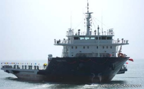
 SANA
SANA
Current Status
Where is the vessel?
SANA is currently in Near LENGEH, based on AIS data received less than 1h ago.
Latest AIS update:
Current position: 26.52994° N, 54.91372° E (Near LENGEH)
Average speed (last 7 days): Loading…
Average speed (last 30 days): Loading…
Vessel profile: SANA is a Cargo with dimensions m x m.
This page combines live AIS, route history, probable destination signals, nearby traffic, and port activity for practical vessel monitoring.
The current position of vessel SANA is 26.52994 lat / 54.91372 lng. Updated: 2026-04-14 04:16:24 UTCNearest reference points:
- Near LENGEH
- 20 nm NW of Hulaylah Terminal
- 13 nm NW of Hulaylah Terminal
Currently sailing under the flag of Panama ![]()
Details:
Live Vessel SANA Analytics (details, animations, etc.)
Recent AIS points (UTC):
2026-04-13 21:58:04 UTC · 26.52990, 54.91372 · SOG 0 kn · COG -1°2026-04-13 23:51:16 UTC · 26.52988, 54.91378 · SOG 0 kn · COG -1°
2026-04-14 02:37:15 UTC · 26.52982, 54.91378 · SOG 0.1 kn · COG -1°
2026-04-14 04:16:24 UTC · 26.52994, 54.91372 · SOG 0.1 kn · COG -1°