 vesseltracker.com
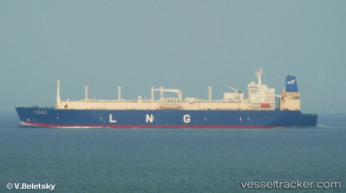
 K. FREESIA
Current Status
Where is the vessel?
K. FREESIA is currently in 84 nm NE of Lakuramau, based on AIS data received less than 1h ago.
Latest AIS update:
Current position: 1.61424° S, 151.83084° E (84 nm NE of Lakuramau)
Average speed (last 7 days): Loading…
Average speed (last 30 days): Loading…
Vessel profile: K. FREESIA is a Lng Tanker with dimensions m x m.
This page combines live AIS, route history, probable destination signals, nearby traffic, and port activity for practical vessel monitoring.
The current position of vessel K. FREESIA is -1.61424 lat / 151.83084 lng. Updated: 2026-04-20 22:23:18 UTCCurrently sailing under the flag of Panama ![]()
Details:
Live Vessel K. FREESIA Analytics (details, animations, etc.)
Recent AIS points (UTC):
2026-04-20 19:23:25 UTC · -1.02939, 151.08159 · SOG 18.7 kn · COG 127°2026-04-20 19:27:38 UTC · -1.04348, 151.09889 · SOG 18.7 kn · COG 126°
2026-04-20 21:31:41 UTC · -1.44806, 151.61188 · SOG 19.1 kn · COG 127°
2026-04-20 22:23:18 UTC · -1.61424, 151.83084 · SOG 19.2 kn · COG 127°