 vesseltracker.com
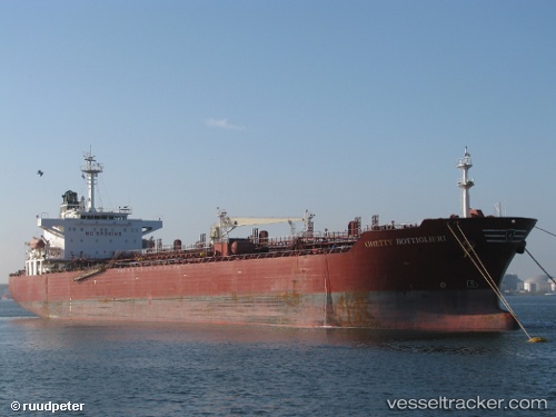
 SEAFAITH
Current Status
Where is the vessel?
SEAFAITH is currently in Near TANAH MERAH, based on AIS data received about 1h ago.
Latest AIS update:
Current position: 1.26893° N, 104.01803° E (Near TANAH MERAH)
Average speed (last 7 days): Loading…
Average speed (last 30 days): Loading…
Vessel profile: SEAFAITH is a Oil/Chemical Tanker with dimensions m x m.
This page combines live AIS, route history, probable destination signals, nearby traffic, and port activity for practical vessel monitoring.
The current position of vessel SEAFAITH is 1.26893 lat / 104.01803 lng. Updated: 2026-04-05 11:24:04 UTCNearest reference points:
- Near TANAH MERAH
- Near Changi
- Near BATU AMPAR
Currently sailing under the flag of Panama ![]()
Details:
Live Vessel SEAFAITH Analytics (details, animations, etc.)
Recent AIS points (UTC):
2026-04-05 05:17:56 UTC · 1.64238, 104.70319 · SOG 11.5 kn · COG 225°2026-04-05 07:42:07 UTC · 1.40755, 104.43287 · SOG 9 kn · COG 234°
2026-04-05 09:51:55 UTC · 1.28953, 104.20183 · SOG 7.1 kn · COG 257°
2026-04-05 11:24:04 UTC · 1.26893, 104.01803 · SOG 5.5 kn · COG 260°