 vesseltracker.com
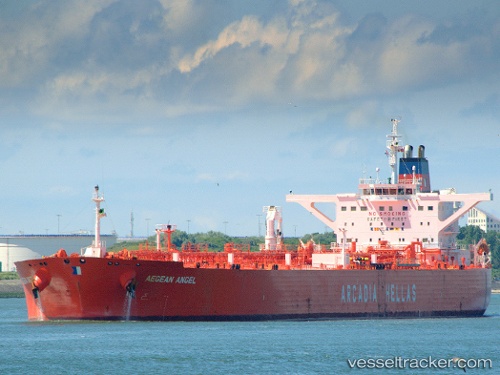
 LADY LOUISE
Current Status
Where is the vessel?
LADY LOUISE is currently in 91 nm SE of Port Raysut, based on AIS data received less than 1h ago.
Latest AIS update:
Current position: 15.85868° N, 55.13420° E (91 nm SE of Port Raysut)
Average speed (last 7 days): Loading…
Average speed (last 30 days): Loading…
Vessel profile: LADY LOUISE is a Crude Oil Tanker with dimensions m x m.
This page combines live AIS, route history, probable destination signals, nearby traffic, and port activity for practical vessel monitoring.
The current position of vessel LADY LOUISE is 15.85868 lat / 55.13420 lng. Updated: 2026-04-19 00:22:48 UTCNearest reference points:
- 103 nm S of Port Raysut
- 106 nm S of Port Raysut
- 110 nm NE of Gross Koris
Currently sailing under the flag of Panama ![]()
Details:
Live Vessel LADY LOUISE Analytics (details, animations, etc.)
Recent AIS points (UTC):
2026-04-18 17:36:18 UTC · 16.79680, 56.45955 · SOG 14.5 kn · COG 232°2026-04-18 20:17:20 UTC · 16.42320, 55.93207 · SOG 13.6 kn · COG 235°
2026-04-18 22:21:27 UTC · 16.13772, 55.52742 · SOG 14 kn · COG 238°
2026-04-19 00:22:48 UTC · 15.85868, 55.13420 · SOG 13.8 kn · COG 234°