 vesseltracker.com
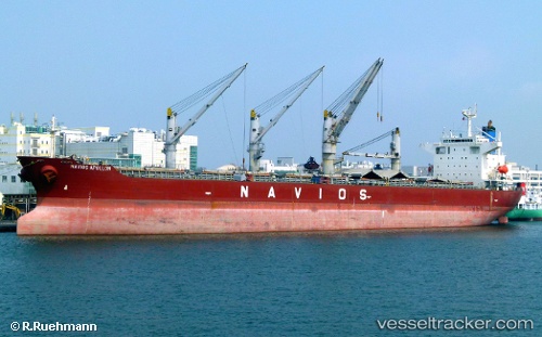
 RUI AN YANG
Current Status
Where is the vessel?
RUI AN YANG is currently in 33 nm N of Charlotteville, based on AIS data received about 1h ago.
Latest AIS update:
Current position: 11.86167° N, 60.48667° W (33 nm N of Charlotteville)
Average speed (last 7 days): Loading…
Average speed (last 30 days): Loading…
Vessel profile: RUI AN YANG is a Bulk Carrier with dimensions m x m.
This page combines live AIS, route history, probable destination signals, nearby traffic, and port activity for practical vessel monitoring.
The current position of vessel RUI AN YANG is 11.86167 lat / -60.48667 lng. Updated: 2026-04-17 21:50:44 UTCNearest reference points:
- Near St. Georges
- Near ST GEORGES
- 16 nm SW of Carriacou Apt
Currently sailing under the flag of Panama ![]()
Details:
Live Vessel RUI AN YANG Analytics (details, animations, etc.)
Recent AIS points (UTC):
2026-04-17 15:38:41 UTC · 11.35333, -61.13833 · SOG 7 kn · COG -1°2026-04-17 17:50:44 UTC · 11.53333, -60.91667 · SOG 7 kn · COG -1°
2026-04-17 19:18:17 UTC · 11.65797, -60.77753 · SOG 8.1 kn · COG -1°
2026-04-17 21:50:44 UTC · 11.86167, -60.48667 · SOG 8 kn · COG -1°