 vesseltracker.com
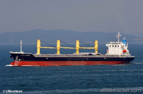
 V CETUS
Current Status
Where is the vessel?
V CETUS is currently in 61 nm NW of Vescovato, based on AIS data received about 1h ago.
Latest AIS update:
Current position: 42.86375° N, 10.70800° W (61 nm NW of Vescovato)
Average speed (last 7 days): Loading…
Average speed (last 30 days): Loading…
Vessel profile: V CETUS is a Bulk Carrier with dimensions m x m.
This page combines live AIS, route history, probable destination signals, nearby traffic, and port activity for practical vessel monitoring.
The current position of vessel V CETUS is 42.86375 lat / -10.70800 lng. Updated: 2026-04-19 19:39:34 UTCNearest reference points:
- 40 nm NW of Sarinena
- 11 nm S of Sarinena
- 20 nm SE of Bear River City
Currently sailing under the flag of Panama ![]()
Details:
Live Vessel V CETUS Analytics (details, animations, etc.)
Recent AIS points (UTC):
2026-04-19 16:16:15 UTC · 43.48317, -10.50985 · SOG 10.9 kn · COG 196°2026-04-19 18:01:45 UTC · 43.16427, -10.61699 · SOG 11.4 kn · COG 195°
2026-04-19 19:15:14 UTC · 42.93783, -10.68782 · SOG 11.2 kn · COG 194°
2026-04-19 19:39:34 UTC · 42.86375, -10.70800 · SOG 11.1 kn · COG 195°