 vesseltracker.com
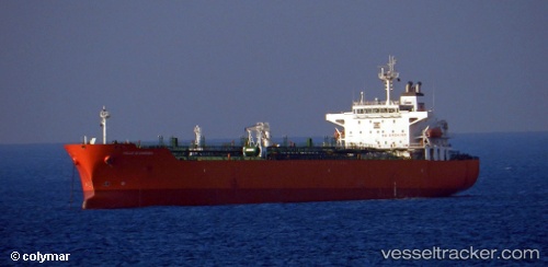
 ELORA 1
Current Status
Where is the vessel?
ELORA 1 is currently in Near Offshore Fujairah, based on AIS data received less than 1h ago.
Latest AIS update:
Current position: 25.28864° N, 56.57890° E (Near Offshore Fujairah)
Average speed (last 7 days): Loading…
Average speed (last 30 days): Loading…
Vessel profile: ELORA 1 is a Oil/Chemical Tanker with dimensions m x m.
This page combines live AIS, route history, probable destination signals, nearby traffic, and port activity for practical vessel monitoring.
The current position of vessel ELORA 1 is 25.28864 lat / 56.57890 lng. Updated: 2026-04-14 16:20:03 UTCNearest reference points:
- Near Offshore Fujairah
- Near KHORFAKKAN
- Near Fujairah
Currently sailing under the flag of Panama ![]()
Details:
Live Vessel ELORA 1 Analytics (details, animations, etc.)
Recent AIS points (UTC):
2026-04-14 09:25:54 UTC · 25.28722, 56.57450 · SOG 0 kn · COG 74°2026-04-14 11:42:57 UTC · 25.28667, 56.57333 · SOG 0 kn · COG -1°
2026-04-14 14:08:01 UTC · 25.28607, 56.57836 · SOG 0.4 kn · COG 300°
2026-04-14 16:20:03 UTC · 25.28864, 56.57890 · SOG 0.5 kn · COG 261°