 vesseltracker.com
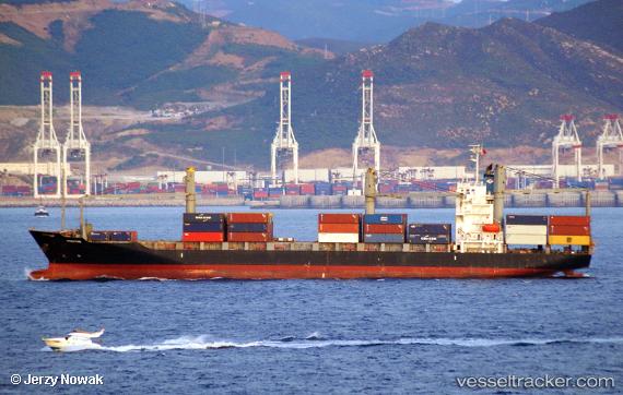
 SOLUNITY
Current Status
Where is the vessel?
SOLUNITY is currently in Near Madras, based on AIS data received less than 1h ago.
Latest AIS update:
Current position: 13.10727° N, 80.30040° E (Near Madras)
Average speed (last 7 days): Loading…
Average speed (last 30 days): Loading…
Vessel profile: SOLUNITY is a Container Ship with dimensions m x m.
This page combines live AIS, route history, probable destination signals, nearby traffic, and port activity for practical vessel monitoring.
The current position of vessel SOLUNITY is 13.10727 lat / 80.30040 lng. Updated: 2026-04-23 06:14:01 UTCNearest reference points:
- Near Chennai (ex Madras)
- Near Madras
- 17 nm NE of Nandiambakkam
Currently sailing under the flag of Panama ![]()
Details:
Live Vessel SOLUNITY Analytics (details, animations, etc.)
Recent AIS points (UTC):
2026-04-23 00:03:14 UTC · 12.74008, 80.58472 · SOG 13.2 kn · COG 330°2026-04-23 03:50:54 UTC · 13.10870, 80.30040 · SOG 0 kn · COG 16°
2026-04-23 04:14:01 UTC · 13.10875, 80.30112 · SOG 0.1 kn · COG 16°
2026-04-23 06:14:01 UTC · 13.10727, 80.30040 · SOG 0 kn · COG 16°