 vesseltracker.com
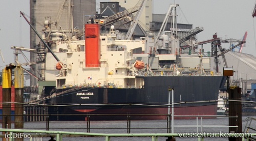
Vessel Andalucia IMO: 9370745, MMSI: 352017000 Wood Chips Carrier
UTC, 38.52579, 120.94910, course: 118, speed: 13.1
UTC, 38.31977, 121.37821, course: 120, speed: 13.2
2026-02-25 19:25:10 UTC, 38.15269, 121.76065, course: 121, speed: 13.2
Live AIS position:
UTC. 39 nm NW of Weihaiwei),
updated 2026-02-25 19:25:10 UTC.
Find the position of the vessel Andalucia on the map. The latter are known coordinates and path.
marine traffic ship tracker show on live map
The current position of vessel Andalucia is 38.15269 lat / 121.76065 lng. Updated: 2026-02-25 19:25:10 UTCDetails:
Last coordinates of the vessel:
UTC, 38.40126, 120.51059, course: 35, speed: 13.2UTC, 38.52579, 120.94910, course: 118, speed: 13.1
UTC, 38.31977, 121.37821, course: 120, speed: 13.2
2026-02-25 19:25:10 UTC, 38.15269, 121.76065, course: 121, speed: 13.2