 vesseltracker.com
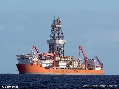
West Saturn
Current StatusWhere is the vessel?
West Saturn is currently in 63 nm W of Cidade de Angra dos Reis FPSO, based on AIS data received about 20h ago.
Latest AIS update:
Current position: 25.41817° S, 43.98067° W (63 nm W of Cidade de Angra dos Reis FPSO)
Average speed (last 7 days): Loading…
Average speed (last 30 days): Loading…
Vessel profile: West Saturn is a Drilling Ship with dimensions 42m x 227m.
This page combines live AIS, route history, probable destination signals, nearby traffic, and port activity for practical vessel monitoring.
The current position of vessel West Saturn is -25.41817 lat / -43.98067 lng. Updated: 2026-04-10 07:18:44 UTCNearest reference points:
- 61 nm S of TEBIG
- 34 nm S of Cidade de Angra dos Reis FPSO
- 49 nm S of SEPETIBA
Details:
Live Vessel West Saturn Analytics (details, animations, etc.)
Recent AIS points (UTC):
2026-04-10 02:04:32 UTC · -25.41833, -43.98067 · SOG 0.2 kn · COG 20°2026-04-10 03:25:33 UTC · -25.41817, -43.98067 · SOG 0.3 kn · COG 20°
2026-04-10 06:01:16 UTC · -25.41817, -43.98067 · SOG 0.4 kn · COG 19°
2026-04-10 07:18:44 UTC · -25.41817, -43.98067 · SOG 0.3 kn · COG 19°