 vesseltracker.com
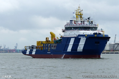
Moonrise g
Current StatusWhere is the vessel?
Moonrise g is currently in 118 nm E of Punta Medanos, based on AIS data received about 5h ago.
Latest AIS update:
Current position: 37.07500° S, 54.22667° W (118 nm E of Punta Medanos)
Average speed (last 7 days): Loading…
Average speed (last 30 days): Loading…
Vessel profile: Moonrise g is a Offshore Tug Supply Ship with dimensions 16m x 60m.
This page combines live AIS, route history, probable destination signals, nearby traffic, and port activity for practical vessel monitoring.
The current position of vessel Moonrise g is -37.07500 lat / -54.22667 lng. Updated: 2026-04-05 09:45:52 UTCNearest reference points:
- 91 nm SE of Punta Medanos
- 75 nm SE of LA PALOMA
- 21 nm E of PUNTA DEL ESTE
Details:
Live Vessel Moonrise g Analytics (details, animations, etc.)
Recent AIS points (UTC):
2026-04-05 05:06:10 UTC · -36.82316, -53.98979 · SOG 4.5 kn · COG 216°2026-04-05 05:48:29 UTC · -36.86453, -54.02568 · SOG 5 kn · COG 222°
2026-04-05 08:05:18 UTC · -36.99139, -54.14878 · SOG 3.7 kn · COG 221°
2026-04-05 09:45:52 UTC · -37.07500, -54.22667 · SOG 3 kn · COG -1°