 vesseltracker.com
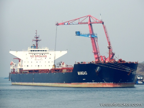
 MANGAS
Current Status
Where is the vessel?
MANGAS is currently in Open sea (no nearby ports in database), based on AIS data received about 1d ago.
Latest AIS update:
Current position: 2.63631° S, 84.05120° E (Open sea (no nearby ports in database))
Average speed (last 7 days): Loading…
Average speed (last 30 days): Loading…
Vessel profile: MANGAS is a Bulk Carrier with dimensions 45m x 288m.
This page combines live AIS, route history, probable destination signals, nearby traffic, and port activity for practical vessel monitoring.
The current position of vessel MANGAS is -2.63631 lat / 84.05120 lng. Updated: 2026-04-10 04:18:10 UTCNearest reference points:
- Open sea (no nearby ports in database)
Currently sailing under the flag of Panama ![]()
MANGAS built in 2011 year
Deadweight:
173918 tDetails:
Live Vessel MANGAS Analytics (details, animations, etc.)
Recent AIS points (UTC):
2026-04-10 01:10:30 UTC · -3.00981, 83.57961 · SOG 11.5 kn · COG -1°2026-04-10 02:05:08 UTC · -2.90144, 83.71728 · SOG 11.1 kn · COG 53°
2026-04-10 04:18:10 UTC · -2.63631, 84.05120 · SOG 11.6 kn · COG 50°
2026-04-10 04:18:10 UTC · -2.63631, 84.05120 · SOG 11.6 kn · COG 50°