 vesseltracker.com
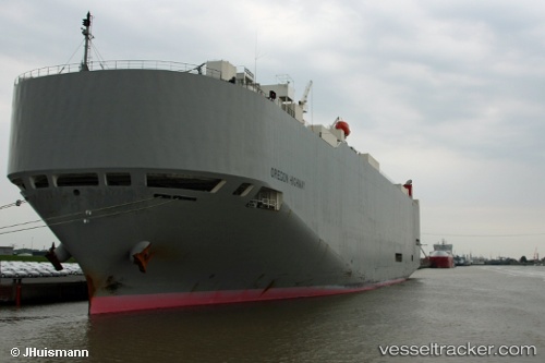
Oregon Highway
Current StatusWhere is the vessel?
Oregon Highway is currently in 309 nm S of Harper, based on AIS data received less than 1h ago.
Latest AIS update:
Current position: 0.68860° S, 8.68410° W (309 nm S of Harper)
Average speed (last 7 days): Loading…
Average speed (last 30 days): Loading…
Vessel profile: Oregon Highway is a Vehicles Carrier with dimensions 32m x 199m.
This page combines live AIS, route history, probable destination signals, nearby traffic, and port activity for practical vessel monitoring.
The current position of vessel Oregon Highway is -0.68860 lat / -8.68410 lng. Updated: 2026-04-17 05:45:02 UTCNearest reference points:
- Open sea, approx. 402 nm off the nearest listed port
- Open sea, approx. 403 nm off the nearest listed port
- Open sea, approx. 401 nm off the nearest listed port
Details:
Live Vessel Oregon Highway Analytics (details, animations, etc.)
Recent AIS points (UTC):
2026-04-16 23:36:29 UTC · -2.16952, -7.61090 · SOG 17.8 kn · COG 325°2026-04-17 02:05:39 UTC · -1.56979, -8.04442 · SOG 17.8 kn · COG 326°
2026-04-17 04:08:25 UTC · -1.07958, -8.40411 · SOG 17.8 kn · COG 326°
2026-04-17 05:45:02 UTC · -0.68860, -8.68410 · SOG 17.9 kn · COG 325°