 vesseltracker.com
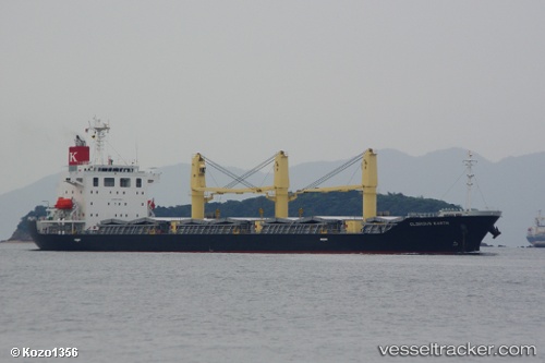
Glorious Earth
Current StatusWhere is the vessel?
Glorious Earth is currently in 128 nm W of LHOKNGA, based on AIS data received less than 1h ago.
Latest AIS update:
Current position: 5.96540° N, 93.15238° E (128 nm W of LHOKNGA)
Average speed (last 7 days): Loading…
Average speed (last 30 days): Loading…
Vessel profile: Glorious Earth is a Bulk Carrier with dimensions 27m x 157m.
This page combines live AIS, route history, probable destination signals, nearby traffic, and port activity for practical vessel monitoring.
The current position of vessel Glorious Earth is 5.96540 lat / 93.15238 lng. Updated: 2026-04-22 03:27:40 UTCNearest reference points:
- 160 nm W of Sebang
- 172 nm W of LHOKNGA
- 80 nm W of Sebang
Details:
Live Vessel Glorious Earth Analytics (details, animations, etc.)
Recent AIS points (UTC):
2026-04-22 00:13:29 UTC · 5.97366, 93.79886 · SOG 12.2 kn · COG 267°2026-04-22 01:10:40 UTC · 5.96207, 93.61047 · SOG 11.9 kn · COG 273°
2026-04-22 01:59:08 UTC · 5.96358, 93.44746 · SOG 12.1 kn · COG 277°
2026-04-22 03:27:40 UTC · 5.96540, 93.15238 · SOG 12.2 kn · COG 270°