 vesseltracker.com
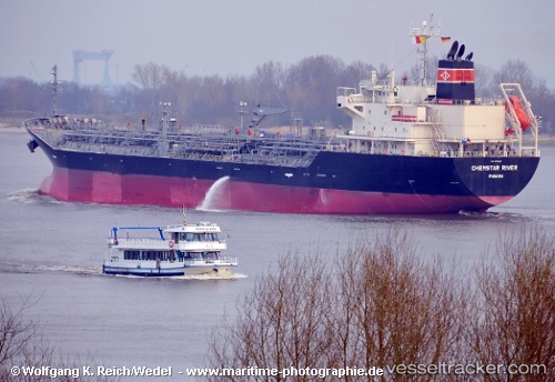
 Chemstar River
Current Status
Where is the vessel?
Chemstar River is currently in Near ARATU, based on AIS data received about 1h ago.
Latest AIS update:
Current position: 12.78307° S, 38.50004° W (Near ARATU)
Average speed (last 7 days): Loading…
Average speed (last 30 days): Loading…
Vessel profile: Chemstar River is a Chemical Oil Products Tanker with dimensions 150m x 150m.
This page combines live AIS, route history, probable destination signals, nearby traffic, and port activity for practical vessel monitoring.
The current position of vessel Chemstar River is -12.78307 lat / -38.50004 lng. Updated: 2026-04-21 11:47:38 UTCNearest reference points:
- Near Aracaju
- Near Barra dos Coqueiros
Currently sailing under the flag of Panama ![]()
Details:
Live Vessel Chemstar River Analytics (details, animations, etc.)
Recent AIS points (UTC):
2026-04-21 07:02:39 UTC · -12.78308, -38.50004 · SOG 0 kn · COG 31°2026-04-21 07:38:38 UTC · -12.78308, -38.50000 · SOG 0 kn · COG 31°
2026-04-21 09:53:39 UTC · -12.78308, -38.50004 · SOG 0 kn · COG 31°
2026-04-21 11:47:38 UTC · -12.78307, -38.50004 · SOG 0 kn · COG 31°