 vesseltracker.com
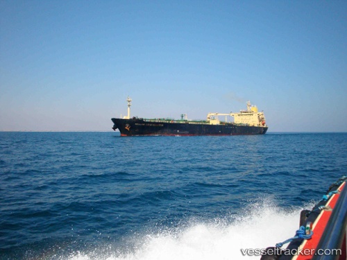
 RAGNAR
Current Status
Where is the vessel?
RAGNAR is currently in 18 nm NE of Tamare, based on AIS data received about 1h ago.
Latest AIS update:
Current position: 11.09524° N, 71.58081° W (18 nm NE of Tamare)
Average speed (last 7 days): Loading…
Average speed (last 30 days): Loading…
Vessel profile: RAGNAR is a Oil Products Tanker with dimensions 32m x 183m.
This page combines live AIS, route history, probable destination signals, nearby traffic, and port activity for practical vessel monitoring.
The current position of vessel RAGNAR is 11.09524 lat / -71.58081 lng. Updated: 2026-04-19 21:00:08 UTCNearest reference points:
- Near PUERTO BOLIVAR
- Near Bachaquero
- Near Las Piedras
Currently sailing under the flag of Panama ![]()
RAGNAR built in 2000 year
Deadweight:
46162 tDetails:
Live Vessel RAGNAR Analytics (details, animations, etc.)
Recent AIS points (UTC):
2026-04-19 02:48:24 UTC · 10.61969, -71.58428 · SOG 0.1 kn · COG -1°2026-04-19 20:05:39 UTC · 10.96406, -71.59996 · SOG 11.1 kn · COG -1°
2026-04-19 20:06:48 UTC · 10.96766, -71.59996 · SOG 11.2 kn · COG -1°
2026-04-19 21:00:08 UTC · 11.09524, -71.58081 · SOG 9.1 kn · COG -1°