 vesseltracker.com
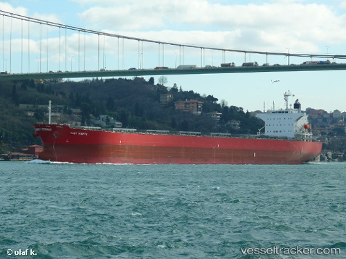
Lady Marite
Current StatusWhere is the vessel?
Lady Marite is currently in Near Kumport, based on AIS data received about 1h ago.
Latest AIS update:
Current position: 40.94317° N, 28.76615° E (Near Kumport)
Average speed (last 7 days): Loading…
Average speed (last 30 days): Loading…
Vessel profile: Lady Marite is a Bulk Carrier with dimensions 32m x 218m.
This page combines live AIS, route history, probable destination signals, nearby traffic, and port activity for practical vessel monitoring.
The current position of vessel Lady Marite is 40.94317 lat / 28.76615 lng. Updated: 2026-04-19 05:59:05 UTCNearest reference points:
- Near Kumport
- Near Küçükçekmece
- Near Ambarli
Details:
Live Vessel Lady Marite Analytics (details, animations, etc.)
Recent AIS points (UTC):
2026-04-18 23:33:31 UTC · 40.94102, 28.77232 · SOG 0.4 kn · COG 319°2026-04-19 01:44:03 UTC · 40.94265, 28.76653 · SOG 0.1 kn · COG 36°
2026-04-19 03:59:18 UTC · 40.94295, 28.76633 · SOG 0 kn · COG 50°
2026-04-19 05:59:05 UTC · 40.94317, 28.76615 · SOG 0 kn · COG 55°