 vesseltracker.com
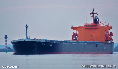
Santa Rosalia
Current StatusWhere is the vessel?
Santa Rosalia is currently in 39 nm SW of Muna na Zirju, based on AIS data received less than 1h ago.
Latest AIS update:
Current position: 43.12993° N, 15.15190° E (39 nm SW of Muna na Zirju)
Average speed (last 7 days): Loading…
Average speed (last 30 days): Loading…
Vessel profile: Santa Rosalia is a Bulk Carrier with dimensions 32m x 225m.
This page combines live AIS, route history, probable destination signals, nearby traffic, and port activity for practical vessel monitoring.
The current position of vessel Santa Rosalia is 43.12993 lat / 15.15190 lng. Updated: 2026-03-29 15:45:18 UTCNearest reference points:
- 26 nm N of Isole Tremiti
- Near Muna na Zirju
- Near Primosten
Details:
Live Vessel Santa Rosalia Analytics (details, animations, etc.)
Recent AIS points (UTC):
2026-03-29 09:58:50 UTC · 42.36593, 16.12802 · SOG 10.8 kn · COG 316°2026-03-29 11:45:19 UTC · 42.60258, 15.82815 · SOG 11 kn · COG 316°
2026-03-29 13:22:28 UTC · 42.81958, 15.55345 · SOG 10.9 kn · COG 316°
2026-03-29 15:45:18 UTC · 43.12993, 15.15190 · SOG 11.4 kn · COG 318°