 vesseltracker.com
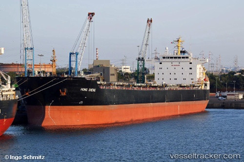
Hong Sheng
Current StatusWhere is the vessel?
Hong Sheng is currently in 46 nm S of Ledong, based on AIS data received about 1h ago.
Latest AIS update:
Current position: 17.88476° N, 108.56265° E (46 nm S of Ledong)
Average speed (last 7 days): Loading…
Average speed (last 30 days): Loading…
Vessel profile: Hong Sheng is a Bulk Carrier with dimensions 32m x 225m.
This page combines live AIS, route history, probable destination signals, nearby traffic, and port activity for practical vessel monitoring.
The current position of vessel Hong Sheng is 17.88476 lat / 108.56265 lng. Updated: 2026-04-12 15:15:51 UTCNearest reference points:
- 24 nm SW of San-Ya Chiang
- 60 nm SW of Ledong
- 14 nm W of San-Ya Chiang
Details:
Live Vessel Hong Sheng Analytics (details, animations, etc.)
Recent AIS points (UTC):
2026-04-12 09:43:20 UTC · 18.59981, 108.10992 · SOG 8.7 kn · COG 151°2026-04-12 12:19:13 UTC · 18.27356, 108.28258 · SOG 8.5 kn · COG 147°
2026-04-12 13:19:19 UTC · 18.15999, 108.39367 · SOG 9.6 kn · COG 146°
2026-04-12 15:15:51 UTC · 17.88476, 108.56265 · SOG 10.5 kn · COG 165°