 vesseltracker.com
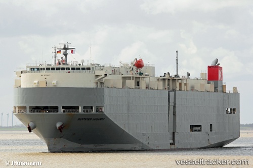
 Rockies Highway
Current Status
Where is the vessel?
Rockies Highway is currently in 70 nm E of Abakaliki, based on AIS data received about 4h ago.
Latest AIS update:
Current position: 5.91486° N, 87.09669° E (70 nm E of Abakaliki)
Average speed (last 7 days): Loading…
Average speed (last 30 days): Loading…
Vessel profile: Rockies Highway is a Vehicles Carrier with dimensions 183m x 30m.
This page combines live AIS, route history, probable destination signals, nearby traffic, and port activity for practical vessel monitoring.
The current position of vessel Rockies Highway is 5.91486 lat / 87.09669 lng. Updated: 2026-04-19 16:58:12 UTCNearest reference points:
- 23 nm S of Abakaliki
- 46 nm SW of Abakaliki
Currently sailing under the flag of Panama ![]()
Rockies Highway built in 2006 year
Deadweight:
12828 tDetails:
Live Vessel Rockies Highway Analytics (details, animations, etc.)
Recent AIS points (UTC):
2026-04-19 16:41:52 UTC · 5.91284, 87.05517 · SOG 9.2 kn · COG 93°2026-04-19 16:58:12 UTC · 5.91486, 87.09669 · SOG 8.8 kn · COG 94°
2026-04-19 16:58:12 UTC · 5.91486, 87.09669 · SOG 8.8 kn · COG 94°
2026-04-19 16:58:12 UTC · 5.91486, 87.09669 · SOG 8.8 kn · COG 94°