 vesseltracker.com
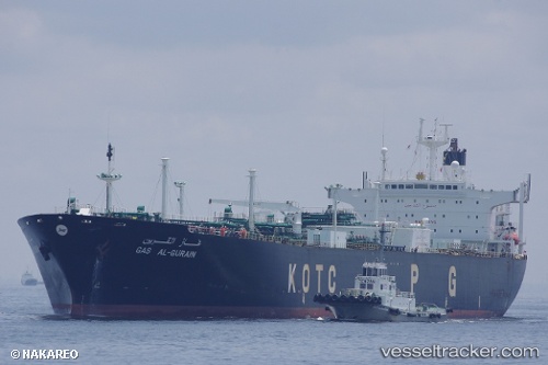
 DIANA
DIANA
Current Status
Where is the vessel?
DIANA is currently in 16 nm NW of Free Port, based on AIS data received about 647d ago.
Latest AIS update:
Current position: 25.44035° N, 55.03123° E (16 nm NW of Free Port)
Average speed (last 7 days): Loading…
Average speed (last 30 days): Loading…
Vessel profile: DIANA is a LPG Tanker with dimensions 230m x 37m.
This page combines live AIS, route history, probable destination signals, nearby traffic, and port activity for practical vessel monitoring.
The current position of vessel DIANA is 25.44035 lat / 55.03123 lng. Updated: 2024-07-04 08:47:33 UTCNearest reference points:
- 17 nm NW of Free Port
- Near Free Port
- Near DUBAI
Currently sailing under the flag of Panama ![]()
DIANA built in 1993 year
Deadweight:
49880 tDetails:
Live Vessel DIANA Analytics (details, animations, etc.)
Recent AIS points (UTC):
2024-07-04 08:47:33 UTC · 25.44035, 55.03123 · SOG 0 kn · COG 284°