 vesseltracker.com
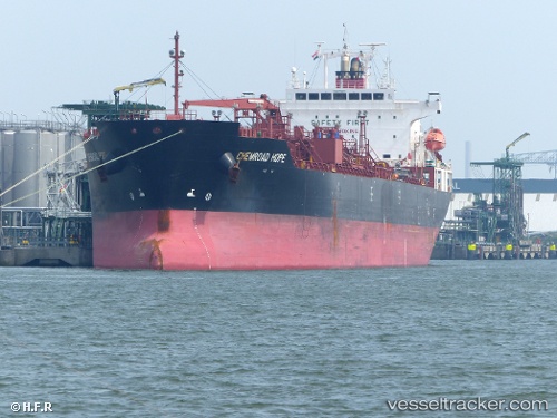
 CHEMROAD HOPE
Current Status
Where is the vessel?
CHEMROAD HOPE is currently in 93 nm W of Geraldton, based on AIS data received about 1h ago.
Latest AIS update:
Current position: 28.38058° S, 112.88528° E (93 nm W of Geraldton)
Average speed (last 7 days): Loading…
Average speed (last 30 days): Loading…
Vessel profile: CHEMROAD HOPE is a Chemical/Oil Products Tanker with dimensions 27m x 170m.
This page combines live AIS, route history, probable destination signals, nearby traffic, and port activity for practical vessel monitoring.
The current position of vessel CHEMROAD HOPE is -28.38058 lat / 112.88528 lng. Updated: 2026-04-09 12:16:06 UTCCurrently sailing under the flag of Panama ![]()
CHEMROAD HOPE built in 2011 year
Deadweight:
33552 tDetails:
Live Vessel CHEMROAD HOPE Analytics (details, animations, etc.)
Recent AIS points (UTC):
2026-04-09 05:52:29 UTC · -29.76333, 113.71801 · SOG 15.5 kn · COG 328°2026-04-09 07:49:18 UTC · -29.33754, 113.39284 · SOG 15.7 kn · COG 324°
2026-04-09 09:33:51 UTC · -28.98006, 113.09207 · SOG 14.5 kn · COG 330°
2026-04-09 12:16:06 UTC · -28.38058, 112.88528 · SOG 14.7 kn · COG 355°