 vesseltracker.com
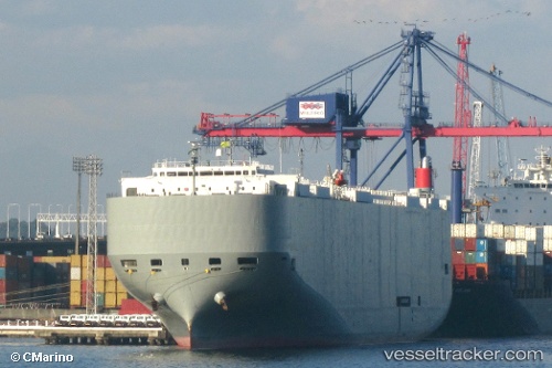
 Brasilia Highway
Current Status
Where is the vessel?
Brasilia Highway is currently in 118 nm N of Swan Island, based on AIS data received less than 1h ago.
Latest AIS update:
Current position: 19.37242° N, 83.87770° W (118 nm N of Swan Island)
Average speed (last 7 days): Loading…
Average speed (last 30 days): Loading…
Vessel profile: Brasilia Highway is a Vehicles Carrier with dimensions 199m x 32m.
This page combines live AIS, route history, probable destination signals, nearby traffic, and port activity for practical vessel monitoring.
The current position of vessel Brasilia Highway is 19.37242 lat / -83.87770 lng. Updated: 2026-04-22 19:25:07 UTCNearest reference points:
- 58 nm S of San Julian
- Near Georgetown, Grand Cayman
Currently sailing under the flag of Panama ![]()
Brasilia Highway built in 2009 year
Deadweight:
18793 tDetails:
Live Vessel Brasilia Highway Analytics (details, animations, etc.)
Recent AIS points (UTC):
2026-04-22 16:12:53 UTC · 19.97987, -84.44372 · SOG 15.6 kn · COG 139°2026-04-22 17:11:57 UTC · 19.78851, -84.26622 · SOG 15.2 kn · COG 134°
2026-04-22 19:05:44 UTC · 19.43482, -83.93213 · SOG 15.1 kn · COG 139°
2026-04-22 19:25:07 UTC · 19.37242, -83.87770 · SOG 14.9 kn · COG 139°