 vesseltracker.com
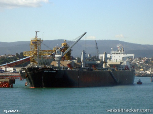
Princess Bright
Current StatusWhere is the vessel?
Princess Bright is currently in 14 nm S of Ha Long, based on AIS data received about 1h ago.
Latest AIS update:
Current position: 20.72361° N, 107.13825° E (14 nm S of Ha Long)
Average speed (last 7 days): Loading…
Average speed (last 30 days): Loading…
Vessel profile: Princess Bright is a Wood Chips Carrier with dimensions 32m x 200m.
This page combines live AIS, route history, probable destination signals, nearby traffic, and port activity for practical vessel monitoring.
The current position of vessel Princess Bright is 20.72361 lat / 107.13825 lng. Updated: 2026-04-19 19:27:52 UTCNearest reference points:
- 14 nm SE of Nam Hai Dinh Vu Port
- 18 nm SE of Ha Long
- 12 nm SE of Nam Hai Dinh Vu Port
Details:
Live Vessel Princess Bright Analytics (details, animations, etc.)
Recent AIS points (UTC):
2026-04-19 15:52:19 UTC · 20.72398, 107.13505 · SOG 0.3 kn · COG -1°2026-04-19 16:16:14 UTC · 20.72443, 107.13751 · SOG 0.1 kn · COG 229°
2026-04-19 18:02:39 UTC · 20.72322, 107.13827 · SOG 0.1 kn · COG -1°
2026-04-19 19:27:52 UTC · 20.72361, 107.13825 · SOG 0 kn · COG -1°