 vesseltracker.com
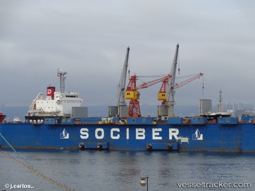
 Balsa 89
Current Status
Where is the vessel?
Balsa 89 is currently in 169 nm SE of Willow Street, based on AIS data received about 1h ago.
Latest AIS update:
Current position: 28.51738° N, 74.66720° W (169 nm SE of Willow Street)
Average speed (last 7 days): Loading…
Average speed (last 30 days): Loading…
Vessel profile: Balsa 89 is a General Cargo Ship with dimensions 106m x 19m.
This page combines live AIS, route history, probable destination signals, nearby traffic, and port activity for practical vessel monitoring.
The current position of vessel Balsa 89 is 28.51738 lat / -74.66720 lng. Updated: 2026-04-21 22:59:52 UTCNearest reference points:
- 113 nm NE of Green Turtle Cay
- 75 nm N of Green Turtle Cay
- Near Green Turtle Cay
Currently sailing under the flag of Panama ![]()
Balsa 89 built in 2013 year
Deadweight:
7760 tDetails:
Live Vessel Balsa 89 Analytics (details, animations, etc.)
Recent AIS points (UTC):
2026-04-21 19:25:12 UTC · 27.99445, -74.66918 · SOG 8 kn · COG 10°2026-04-21 21:44:51 UTC · 28.32824, -74.66747 · SOG 8.9 kn · COG 6°
2026-04-21 22:20:29 UTC · 28.41716, -74.66746 · SOG 9 kn · COG 5°
2026-04-21 22:59:52 UTC · 28.51738, -74.66720 · SOG 8.3 kn · COG 7°