 vesseltracker.com
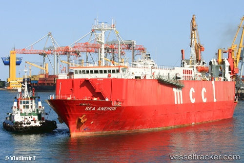
Sea Anemos
Current StatusWhere is the vessel?
Sea Anemos is currently in 18 nm NW of Marrara, based on AIS data received about 1h ago.
Latest AIS update:
Current position: 12.22499° S, 130.65977° E (18 nm NW of Marrara)
Average speed (last 7 days): Loading…
Average speed (last 30 days): Loading…
Vessel profile: Sea Anemos is a Vehicles Carrier with dimensions 17m x 106m.
This page combines live AIS, route history, probable destination signals, nearby traffic, and port activity for practical vessel monitoring.
The current position of vessel Sea Anemos is -12.22499 lat / 130.65977 lng. Updated: 2026-04-06 15:43:56 UTCNearest reference points:
- Near Winnellie
- Near Palmerston
Details:
Live Vessel Sea Anemos Analytics (details, animations, etc.)
Recent AIS points (UTC):
2026-04-06 10:10:53 UTC · -12.22323, 130.66454 · SOG 0 kn · COG 226°2026-04-06 11:34:55 UTC · -12.22351, 130.66002 · SOG 0.4 kn · COG 119°
2026-04-06 13:37:56 UTC · -12.22425, 130.65977 · SOG 0.1 kn · COG 100°
2026-04-06 15:43:56 UTC · -12.22499, 130.65977 · SOG 0.1 kn · COG 82°