 vesseltracker.com
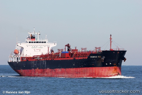
 Chemroad Sea
Current Status
Where is the vessel?
Chemroad Sea is currently in 53 nm S of Slipi, based on AIS data received about 3h ago.
Latest AIS update:
Current position: 5.35323° N, 107.07425° E (53 nm S of Slipi)
Average speed (last 7 days): Loading…
Average speed (last 30 days): Loading…
Vessel profile: Chemroad Sea is a Chemical Oil Products Tanker with dimensions 170m x 172m.
This page combines live AIS, route history, probable destination signals, nearby traffic, and port activity for practical vessel monitoring.
The current position of vessel Chemroad Sea is 5.35323 lat / 107.07425 lng. Updated: 2026-04-18 02:15:16 UTCNearest reference points:
- 46 nm E of Kakap Natuna Terminal
- 36 nm SW of Slipi
- 45 nm E of Kakap Natuna Terminal
Currently sailing under the flag of Panama ![]()
Chemroad Sea built in 2011 year
Deadweight:
33560 tDetails:
Live Vessel Chemroad Sea Analytics (details, animations, etc.)
Recent AIS points (UTC):
2026-04-17 20:00:55 UTC · 4.46031, 106.10857 · SOG 12.9 kn · COG 45°2026-04-17 23:30:46 UTC · 4.97893, 106.63350 · SOG 12.3 kn · COG 50°
2026-04-18 02:15:16 UTC · 5.35323, 107.07425 · SOG 13 kn · COG 48°
2026-04-18 02:15:16 UTC · 5.35323, 107.07425 · SOG 13 kn · COG 48°