 vesseltracker.com
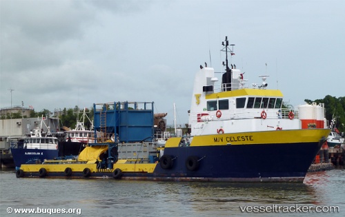
Celeste
Current StatusWhere is the vessel?
Celeste is currently in Near CARENAGE, based on AIS data received about 415d ago.
Latest AIS update:
Current position: 10.68175° N, 61.61921° W (Near CARENAGE)
Average speed (last 7 days): Loading…
Average speed (last 30 days): Loading…
Vessel profile: Celeste is a Offshore Tug Supply Ship with dimensions 11m x 31m.
This page combines live AIS, route history, probable destination signals, nearby traffic, and port activity for practical vessel monitoring.
The current position of vessel Celeste is 10.68175 lat / -61.61921 lng. Updated: 2025-02-25 16:25:01 UTCNearest reference points:
- Near CARENAGE
- Near Carenage
- Near Caroni
Details:
Live Vessel Celeste Analytics (details, animations, etc.)
Recent AIS points (UTC):
2025-02-25 16:25:01 UTC · 10.68175, -61.61921 · SOG 0 kn · COG -1°