 vesseltracker.com
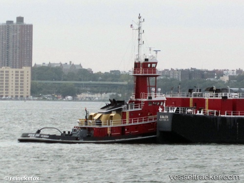
Evening Star
Current StatusWhere is the vessel?
Evening Star is currently in Near PORT ARANSAS, based on AIS data received less than 1h ago.
Latest AIS update:
Current position: 27.84316° N, 97.07446° W (Near PORT ARANSAS)
Average speed (last 7 days): Loading…
Average speed (last 30 days): Loading…
Vessel profile: Evening Star is a Pusher Tug with dimensions 21m x 122m.
This page combines live AIS, route history, probable destination signals, nearby traffic, and port activity for practical vessel monitoring.
The current position of vessel Evening Star is 27.84316 lat / -97.07446 lng. Updated: 2026-04-10 02:34:13 UTCNearest reference points:
- Near PORT ARANSAS
- Near Port Aransas
- Near ARANSAS PASS
Details:
Live Vessel Evening Star Analytics (details, animations, etc.)
Recent AIS points (UTC):
2026-04-09 20:19:14 UTC · 27.84319, -97.07447 · SOG 0.1 kn · COG 315°2026-04-09 22:02:25 UTC · 27.84314, -97.07448 · SOG 0 kn · COG -1°
2026-04-09 23:58:14 UTC · 27.84315, -97.07447 · SOG 0 kn · COG 315°
2026-04-10 02:34:13 UTC · 27.84316, -97.07446 · SOG 0 kn · COG 315°