 vesseltracker.com
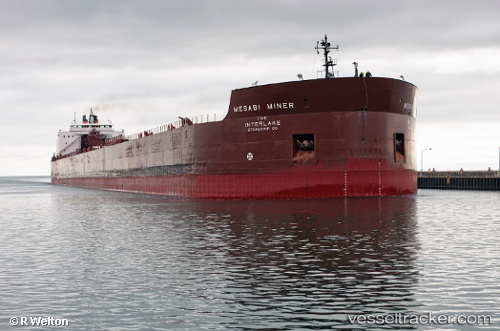
 Mesabi Miner
Current Status
Where is the vessel?
Mesabi Miner is currently in 45 nm SE of McCanna, based on AIS data received less than 1h ago.
Latest AIS update:
Current position: 47.42979° N, 86.99021° W (45 nm SE of McCanna)
Average speed (last 7 days): Loading…
Average speed (last 30 days): Loading…
Vessel profile: Mesabi Miner is a Self Discharging Bulk Carrier with dimensions 305m x 32m.
This page combines live AIS, route history, probable destination signals, nearby traffic, and port activity for practical vessel monitoring.
The current position of vessel Mesabi Miner is 47.42979 lat / -86.99021 lng. Updated: 2026-04-22 19:55:49 UTCNearest reference points:
- Near Mackinaw City
Currently sailing under the flag of USA ![]()
Mesabi Miner built in 1977 year
Deadweight:
62335 tDetails:
Live Vessel Mesabi Miner Analytics (details, animations, etc.)
Recent AIS points (UTC):
2026-04-22 16:48:47 UTC · 47.56844, -87.92339 · SOG 12.9 kn · COG 88°2026-04-22 18:12:05 UTC · 47.57215, -87.48435 · SOG 12.7 kn · COG 87°
2026-04-22 19:11:15 UTC · 47.49356, -87.20237 · SOG 12.7 kn · COG 113°
2026-04-22 19:55:49 UTC · 47.42979, -86.99021 · SOG 12.7 kn · COG 112°