 vesseltracker.com
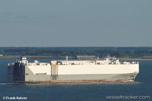
 Alliance St. Louis
Current Status
Where is the vessel?
Alliance St. Louis is currently in Near Santo Domingo, based on AIS data received about 2h ago.
Latest AIS update:
Current position: 18.47139° N, 69.87732° W (Near Santo Domingo)
Average speed (last 7 days): Loading…
Average speed (last 30 days): Loading…
Vessel profile: Alliance St. Louis is a Vehicles Carrier with dimensions 200m x 32m.
This page combines live AIS, route history, probable destination signals, nearby traffic, and port activity for practical vessel monitoring.
The current position of vessel Alliance St. Louis is 18.47139 lat / -69.87732 lng. Updated: 2026-04-02 03:37:55 UTCNearest reference points:
- Near Bahia De Las Calderas
- Near CASA DE CAMPO
- 32 nm N of Punta Cana Apt
Currently sailing under the flag of USA ![]()
Alliance St. Louis built in 2005 year
Deadweight:
15880 tDetails:
Live Vessel Alliance St. Louis Analytics (details, animations, etc.)
Recent AIS points (UTC):
2026-04-01 21:34:19 UTC · 17.80794, -70.67747 · SOG 16.2 kn · COG -1°2026-04-01 23:48:55 UTC · 18.11968, -70.14719 · SOG 15.8 kn · COG -1°
2026-04-02 01:56:32 UTC · 18.46677, -69.88331 · SOG 4.2 kn · COG 49°
2026-04-02 03:37:55 UTC · 18.47139, -69.87732 · SOG 0 kn · COG 342°