 vesseltracker.com
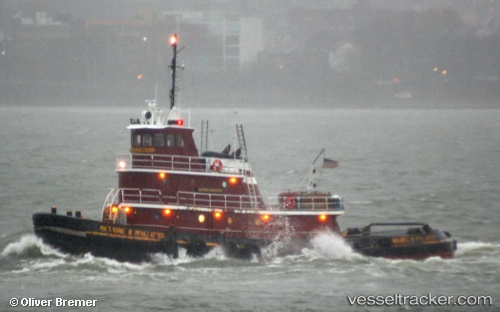
Marjorie B Mcalliste
Current StatusWhere is the vessel?
Marjorie B Mcalliste is currently in Near Maher Terminal, based on AIS data received less than 1h ago.
Latest AIS update:
Current position: 40.65977° N, 74.14171° W (Near Maher Terminal)
Average speed (last 7 days): Loading…
Average speed (last 30 days): Loading…
Vessel profile: Marjorie B Mcalliste is a Tug with dimensions 10m x 32m.
This page combines live AIS, route history, probable destination signals, nearby traffic, and port activity for practical vessel monitoring.
The current position of vessel Marjorie B Mcalliste is 40.65977 lat / -74.14171 lng. Updated: 2026-03-30 20:16:25 UTCNearest reference points:
- Near Port Ivory/Staten Isl/New York
- Near Maher Terminal
- Near Elizabethport
Details:
Live Vessel Marjorie B Mcalliste Analytics (details, animations, etc.)
Recent AIS points (UTC):
2026-03-30 13:44:27 UTC · 40.63893, -74.19211 · SOG 0 kn · COG 70°2026-03-30 15:56:26 UTC · 40.64640, -74.17586 · SOG 8 kn · COG 85°
2026-03-30 17:37:42 UTC · 40.68393, -74.15373 · SOG 5.2 kn · COG 321°
2026-03-30 20:16:25 UTC · 40.65977, -74.14171 · SOG 9.8 kn · COG 21°