 vesseltracker.com
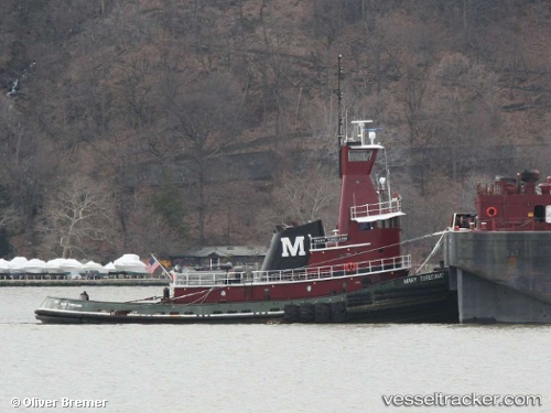
Mary Turecamo
Current StatusWhere is the vessel?
Mary Turecamo is currently in Near Port Ivory/Staten Isl/New York, based on AIS data received less than 1h ago.
Latest AIS update:
Current position: 40.64041° N, 74.12929° W (Near Port Ivory/Staten Isl/New York)
Average speed (last 7 days): Loading…
Average speed (last 30 days): Loading…
Vessel profile: Mary Turecamo is a Tug with dimensions 10m x 36m.
This page combines live AIS, route history, probable destination signals, nearby traffic, and port activity for practical vessel monitoring.
The current position of vessel Mary Turecamo is 40.64041 lat / -74.12929 lng. Updated: 2026-04-07 16:05:07 UTCNearest reference points:
- Near Maher Terminal
- Near Port Ivory/Staten Isl/New York
- Near Elizabethport
Details:
Live Vessel Mary Turecamo Analytics (details, animations, etc.)
Recent AIS points (UTC):
2026-04-07 09:29:03 UTC · 40.64044, -74.12932 · SOG 0 kn · COG 202°2026-04-07 11:56:02 UTC · 40.64046, -74.12929 · SOG 0 kn · COG 201°
2026-04-07 13:59:03 UTC · 40.64041, -74.12929 · SOG 0 kn · COG 206°
2026-04-07 16:05:07 UTC · 40.64041, -74.12929 · SOG 0 kn · COG 205°