 vesseltracker.com
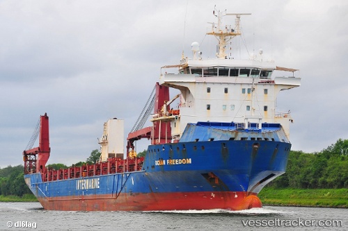
Vessel Ocean Freedom IMO: 9506722, MMSI: 367503980 Heavy Load Carrier
UTC, 15.39587, 86.08582, course: -1, speed: 12.8
UTC, 15.69333, 85.76500, course: -1, speed: 12
2026-03-01 11:55:25 UTC, 16.03747, 85.35415, course: 307, speed: 12
Live AIS position:
UTC. 154 nm SE of VISAKHAPATNAM),
updated 2026-03-01 11:55:25 UTC.
Find the position of the vessel Ocean Freedom on the map. The latter are known coordinates and path.
marine traffic ship tracker show on live map
The current position of vessel Ocean Freedom is 16.03747 lat / 85.35415 lng. Updated: 2026-03-01 11:55:25 UTCDetails:
Last coordinates of the vessel:
UTC, 15.22667, 86.27667, course: -1, speed: 12UTC, 15.39587, 86.08582, course: -1, speed: 12.8
UTC, 15.69333, 85.76500, course: -1, speed: 12
2026-03-01 11:55:25 UTC, 16.03747, 85.35415, course: 307, speed: 12