 vesseltracker.com
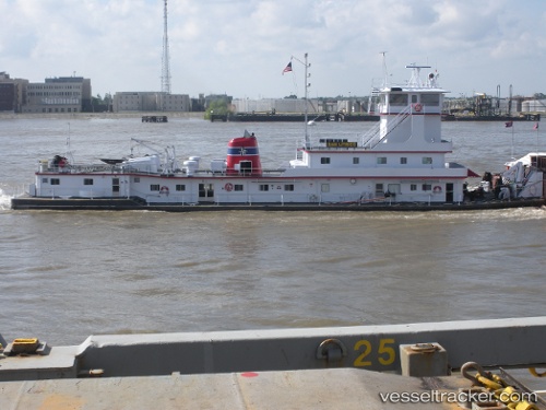
 DAVID M OLOUGHLIN
Current Status
Where is the vessel?
DAVID M OLOUGHLIN is currently in 14 nm S of Caruthersville, based on AIS data received about 2h ago.
Latest AIS update:
Current position: 35.94491° N, 89.67638° W (14 nm S of Caruthersville)
Average speed (last 7 days): Loading…
Average speed (last 30 days): Loading…
Vessel profile: DAVID M OLOUGHLIN is a Spare - Local Vessel with dimensions m x m.
This page combines live AIS, route history, probable destination signals, nearby traffic, and port activity for practical vessel monitoring.
The current position of vessel DAVID M OLOUGHLIN is 35.94491 lat / -89.67638 lng. Updated: 2026-04-20 05:08:20 UTCNearest reference points:
- Near MEMPHIS
- 16 nm E of Holly Springs, Marshall
- Near Olive Branch
Currently sailing under the flag of United States ![]()
Details:
Live Vessel DAVID M OLOUGHLIN Analytics (details, animations, etc.)
Recent AIS points (UTC):
2026-04-20 00:49:40 UTC · 35.94644, -89.67898 · SOG 0.1 kn · COG 320°2026-04-20 02:53:37 UTC · 35.94649, -89.67918 · SOG 0 kn · COG 319°
2026-04-20 03:54:10 UTC · 35.94640, -89.67905 · SOG 0 kn · COG 318°
2026-04-20 05:08:20 UTC · 35.94491, -89.67638 · SOG 0 kn · COG 310°