 vesseltracker.com
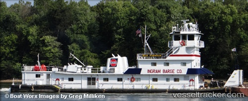
 Rick Harnack
Current Status
Where is the vessel?
Rick Harnack is currently in Near Cumberland City, based on AIS data received less than 1h ago.
Latest AIS update:
Current position: 36.45199° N, 87.71542° W (Near Cumberland City)
Average speed (last 7 days): Loading…
Average speed (last 30 days): Loading…
Vessel profile: Rick Harnack is a Tug with dimensions 40m x 39m.
This page combines live AIS, route history, probable destination signals, nearby traffic, and port activity for practical vessel monitoring.
The current position of vessel Rick Harnack is 36.45199 lat / -87.71542 lng. Updated: 2026-04-13 07:31:09 UTCNearest reference points:
- Near Grand Rivers
- 16 nm E of Holly Springs, Marshall
- Near Evensville
Currently sailing under the flag of USA ![]()
Details:
Live Vessel Rick Harnack Analytics (details, animations, etc.)
Recent AIS points (UTC):
2026-04-13 01:19:23 UTC · 36.85399, -87.97514 · SOG 5.2 kn · COG 192°2026-04-13 01:19:23 UTC · 36.85399, -87.97514 · SOG 5.2 kn · COG 192°
2026-04-13 05:16:31 UTC · 36.54774, -87.87947 · SOG 5.4 kn · COG 149°
2026-04-13 07:31:09 UTC · 36.45199, -87.71542 · SOG 5.6 kn · COG 146°