 vesseltracker.com
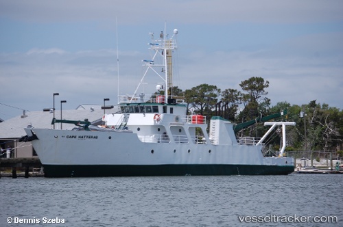
 CAPE HATTERAS
Current Status
Where is the vessel?
CAPE HATTERAS is currently in 175 nm SE of Churchill, based on AIS data received about 227d ago.
Latest AIS update:
Current position: 56.80854° N, 90.15723° W (175 nm SE of Churchill)
Average speed (last 7 days): Loading…
Average speed (last 30 days): Loading…
Vessel profile: CAPE HATTERAS is a Research Vessel with dimensions 12m x 40m.
This page combines live AIS, route history, probable destination signals, nearby traffic, and port activity for practical vessel monitoring.
The current position of vessel CAPE HATTERAS is 56.80854 lat / -90.15723 lng. Updated: 2025-08-28 21:51:11 UTCCurrently sailing under the flag of United States of America ![]()
CAPE HATTERAS built in 1981 year
Deadweight:
198 tDetails:
Live Vessel CAPE HATTERAS Analytics (details, animations, etc.)
Recent AIS points (UTC):
2025-08-28 21:51:11 UTC · 56.80854, -90.15723 · SOG 51.2 kn · COG 2°