 vesseltracker.com
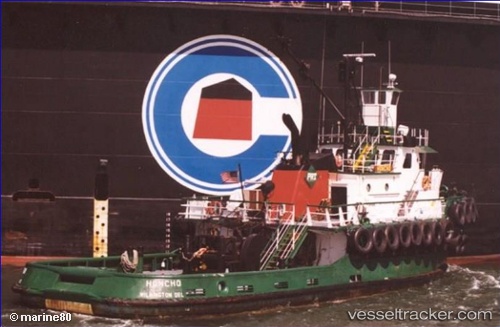
 DON TUTO
Current Status
Where is the vessel?
DON TUTO is currently in Near PHILIPSBURG, based on AIS data received about 1h ago.
Latest AIS update:
Current position: 18.01640° N, 63.04549° W (Near PHILIPSBURG)
Average speed (last 7 days): Loading…
Average speed (last 30 days): Loading…
Vessel profile: DON TUTO is a Tug with dimensions 8m x 32m.
This page combines live AIS, route history, probable destination signals, nearby traffic, and port activity for practical vessel monitoring.
The current position of vessel DON TUTO is 18.01640 lat / -63.04549 lng. Updated: 2026-04-08 11:55:36 UTCNearest reference points:
- Near ST MAARTEN
- Near GUSTAVIA
- Near Spanish Town
Currently sailing under the flag of United States of America ![]()
DON TUTO built in 1975 year
Deadweight:
186 tDetails:
Live Vessel DON TUTO Analytics (details, animations, etc.)
Recent AIS points (UTC):
2026-04-08 05:52:37 UTC · 18.01638, -63.04547 · SOG 0.1 kn · COG 6°2026-04-08 07:22:33 UTC · 18.01639, -63.04547 · SOG 0.1 kn · COG 7°
2026-04-08 09:49:28 UTC · 18.01639, -63.04547 · SOG 0.1 kn · COG 5°
2026-04-08 11:55:36 UTC · 18.01640, -63.04549 · SOG 0.1 kn · COG 7°