 vesseltracker.com
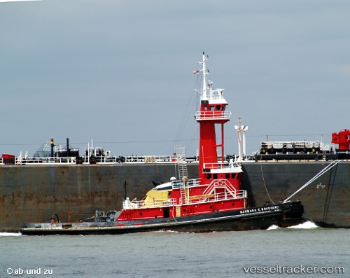
 TURQUOISE COAST
Current Status
Where is the vessel?
TURQUOISE COAST is currently in Near River Ridge, based on AIS data received about 1d ago.
Latest AIS update:
Current position: 29.94541° N, 90.17153° W (Near River Ridge)
Average speed (last 7 days): Loading…
Average speed (last 30 days): Loading…
Vessel profile: TURQUOISE COAST is a Tug with dimensions m x m.
This page combines live AIS, route history, probable destination signals, nearby traffic, and port activity for practical vessel monitoring.
The current position of vessel TURQUOISE COAST is 29.94541 lat / -90.17153 lng. Updated: 2026-04-10 07:39:36 UTCNearest reference points:
- Near Marrero
- Near Boutte
- Near Good Hope
Currently sailing under the flag of United States ![]()
Details:
Live Vessel TURQUOISE COAST Analytics (details, animations, etc.)
Recent AIS points (UTC):
2026-04-10 02:39:02 UTC · 29.94540, -90.17154 · SOG 0 kn · COG 221°2026-04-10 04:20:59 UTC · 29.94544, -90.17154 · SOG 0 kn · COG 222°
2026-04-10 05:26:59 UTC · 29.94541, -90.17155 · SOG 0 kn · COG 221°
2026-04-10 07:39:36 UTC · 29.94541, -90.17153 · SOG 0 kn · COG 221°