 vesseltracker.com
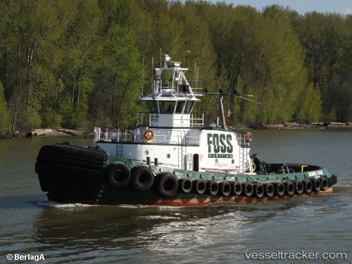
 DANIEL FOSS
Current Status
Where is the vessel?
DANIEL FOSS is currently in Near Deer Island, based on AIS data received about 2h ago.
Latest AIS update:
Current position: 45.84589° N, 122.78553° W (Near Deer Island)
Average speed (last 7 days): Loading…
Average speed (last 30 days): Loading…
Vessel profile: DANIEL FOSS is a Tug with dimensions m x m.
This page combines live AIS, route history, probable destination signals, nearby traffic, and port activity for practical vessel monitoring.
The current position of vessel DANIEL FOSS is 45.84589 lat / -122.78553 lng. Updated: 2026-04-22 23:55:38 UTCNearest reference points:
- Near Linnton
- Near LONGVIEW
- Near Astoria
Currently sailing under the flag of United States ![]()
Details:
Live Vessel DANIEL FOSS Analytics (details, animations, etc.)
Recent AIS points (UTC):
2026-04-22 19:59:30 UTC · 46.08974, -122.92895 · SOG 0 kn · COG 104°2026-04-22 21:32:19 UTC · 46.09145, -122.92776 · SOG 0.8 kn · COG 117°
2026-04-22 22:26:28 UTC · 46.04120, -122.88040 · SOG 8.4 kn · COG 173°
2026-04-22 23:55:38 UTC · 45.84589, -122.78553 · SOG 8.8 kn · COG 189°