 vesseltracker.com
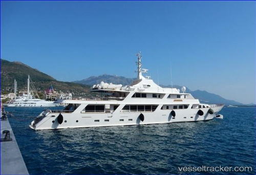
 WHITE KNIGHT
Current Status
Where is the vessel?
WHITE KNIGHT is currently in Near Basseterre, based on AIS data received about 4d ago.
Latest AIS update:
Current position: 17.24402° N, 62.65481° W (Near Basseterre)
Average speed (last 7 days): Loading…
Average speed (last 30 days): Loading…
Vessel profile: WHITE KNIGHT is a Houseboat with dimensions 8m x 40m.
This page combines live AIS, route history, probable destination signals, nearby traffic, and port activity for practical vessel monitoring.
The current position of vessel WHITE KNIGHT is 17.24402 lat / -62.65481 lng. Updated: 2026-04-05 18:07:14 UTCNearest reference points:
- Near GUSTAVIA
- Near Saint John's
- Near ANTIGUA
Currently sailing under the flag of United States of America ![]()
WHITE KNIGHT built in 1985 year
Deadweight:
0 tDetails:
Live Vessel WHITE KNIGHT Analytics (details, animations, etc.)
Recent AIS points (UTC):
2026-04-05 18:07:14 UTC · 17.24402, -62.65481 · SOG 0 kn · COG 149°2026-04-05 18:07:14 UTC · 17.24402, -62.65481 · SOG 0 kn · COG 149°
2026-04-05 18:07:14 UTC · 17.24402, -62.65481 · SOG 0 kn · COG 149°
2026-04-05 18:07:14 UTC · 17.24402, -62.65481 · SOG 0 kn · COG 149°