 vesseltracker.com
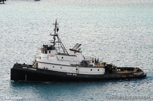
 HARRIET O
Current Status
Where is the vessel?
HARRIET O is currently in 24 nm NE of Coos Bay, based on AIS data received about 7d ago.
Latest AIS update:
Current position: 43.71377° N, 124.10130° W (24 nm NE of Coos Bay)
Average speed (last 7 days): Loading…
Average speed (last 30 days): Loading…
Vessel profile: HARRIET O is a Tug with dimensions m x m.
This page combines live AIS, route history, probable destination signals, nearby traffic, and port activity for practical vessel monitoring.
The current position of vessel HARRIET O is 43.71377 lat / -124.10130 lng. Updated: 2026-04-07 19:51:15 UTCNearest reference points:
- 24 nm NE of Coos Bay
- Near Coos Bay
- Near Lincoln City
Currently sailing under the flag of United States ![]()
Details:
Live Vessel HARRIET O Analytics (details, animations, etc.)
Recent AIS points (UTC):
2026-04-07 17:25:55 UTC · 43.71376, -124.10128 · SOG 0 kn · COG 357°2026-04-07 19:51:15 UTC · 43.71377, -124.10130 · SOG 0 kn · COG 357°
2026-04-07 19:51:15 UTC · 43.71377, -124.10130 · SOG 0 kn · COG 357°
2026-04-07 19:51:15 UTC · 43.71377, -124.10130 · SOG 0 kn · COG 357°