 vesseltracker.com
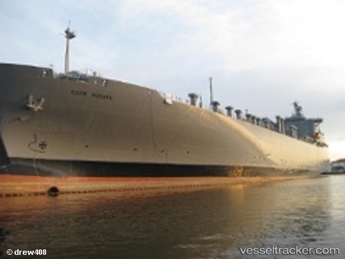
 Cape Ducato
Current Status
Where is the vessel?
Cape Ducato is currently in Near Charleston Heights, based on AIS data received less than 1h ago.
Latest AIS update:
Current position: 32.84990° N, 79.93853° W (Near Charleston Heights)
Average speed (last 7 days): Loading…
Average speed (last 30 days): Loading…
Vessel profile: Cape Ducato is a Vehicles Carrier with dimensions 207m x 207m.
This page combines live AIS, route history, probable destination signals, nearby traffic, and port activity for practical vessel monitoring.
The current position of vessel Cape Ducato is 32.84990 lat / -79.93853 lng. Updated: 2026-04-17 21:56:00 UTCNearest reference points:
- Near Charleston
- 33 nm S of Kiawah Island
- Near Saint Andrews
Currently sailing under the flag of USA ![]()
Cape Ducato built in 1972 year
Deadweight:
23725 tDetails:
Live Vessel Cape Ducato Analytics (details, animations, etc.)
Recent AIS points (UTC):
2026-04-17 15:22:58 UTC · 32.84987, -79.93850 · SOG 0 kn · COG 55°2026-04-17 17:46:59 UTC · 32.84995, -79.93856 · SOG 0 kn · COG 55°
2026-04-17 20:02:02 UTC · 32.84992, -79.93854 · SOG 0 kn · COG 55°
2026-04-17 21:56:00 UTC · 32.84990, -79.93853 · SOG 0 kn · COG 55°