 vesseltracker.com
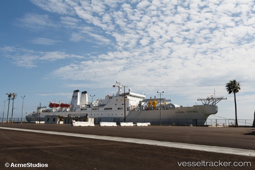
 Us Government Vessel
Current Status
Where is the vessel?
Us Government Vessel is currently in Near Ilfracombe, based on AIS data received about 12d ago.
Latest AIS update:
Current position: 51.32187° N, 4.03362° W (Near Ilfracombe)
Average speed (last 7 days): Loading…
Average speed (last 30 days): Loading…
Vessel profile: Us Government Vessel is a Cable Layer with dimensions 146m x 22m.
This page combines live AIS, route history, probable destination signals, nearby traffic, and port activity for practical vessel monitoring.
The current position of vessel Us Government Vessel is 51.32187 lat / -4.03362 lng. Updated: 2026-03-21 11:59:37 UTCNearest reference points:
- Near Black Pill
- Near Landore
- Near Leckwith
Currently sailing under the flag of USA ![]()
Us Government Vessel built in 1991 year
Deadweight:
8527 tDetails:
Live Vessel Us Government Vessel Analytics (details, animations, etc.)
Recent AIS points (UTC):
2026-03-21 11:59:37 UTC · 51.32187, -4.03362 · SOG 12.7 kn · COG 261°2026-03-21 11:59:37 UTC · 51.32187, -4.03362 · SOG 12.7 kn · COG 261°
2026-03-21 11:59:37 UTC · 51.32187, -4.03362 · SOG 12.7 kn · COG 261°
2026-03-21 11:59:37 UTC · 51.32187, -4.03362 · SOG 12.7 kn · COG 261°