 vesseltracker.com
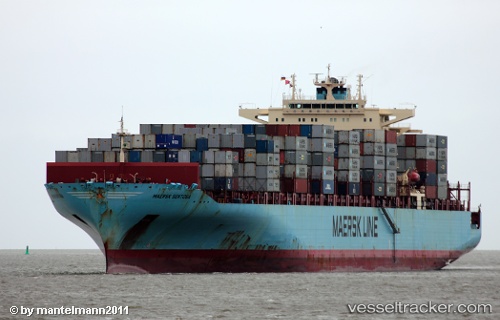
 Maersk Sentosa
Current Status
Where is the vessel?
Maersk Sentosa is currently in 24 nm E of Rodanthe, based on AIS data received about 1h ago.
Latest AIS update:
Current position: 35.70333° N, 74.99166° W (24 nm E of Rodanthe)
Average speed (last 7 days): Loading…
Average speed (last 30 days): Loading…
Vessel profile: Maersk Sentosa is a Container Ship with dimensions 319m x 318m.
This page combines live AIS, route history, probable destination signals, nearby traffic, and port activity for practical vessel monitoring.
The current position of vessel Maersk Sentosa is 35.70333 lat / -74.99166 lng. Updated: 2026-04-02 09:52:04 UTCNearest reference points:
- 18 nm NE of Rodanthe
- 48 nm E of Nags Head
- 45 nm NE of Nags Head
Currently sailing under the flag of USA ![]()
Maersk Sentosa built in 2007 year
Deadweight:
85250 tDetails:
Live Vessel Maersk Sentosa Analytics (details, animations, etc.)
Recent AIS points (UTC):
2026-04-02 03:30:05 UTC · 37.19440, -74.57616 · SOG 14.6 kn · COG -1°2026-04-02 06:03:27 UTC · 36.60167, -74.74333 · SOG 14 kn · COG -1°
2026-04-02 08:25:31 UTC · 36.04087, -74.88827 · SOG 14.5 kn · COG 195°
2026-04-02 09:52:04 UTC · 35.70333, -74.99166 · SOG 15 kn · COG -1°